
- cross-posted to:
- ecosocial@news.abolish.capital
- cross-posted to:
- ecosocial@news.abolish.capital
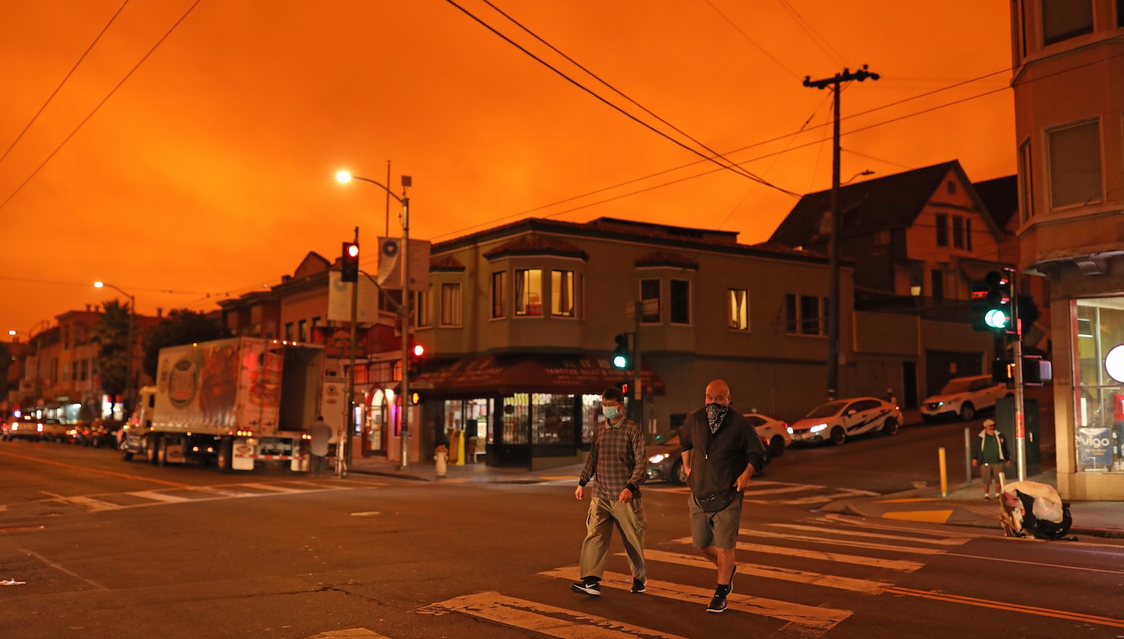
Wildfire smoke is an emerging nationwide crisis for the United States. Supercharged by climate change, blazes are swelling into monsters that consume vast landscapes and entire towns. A growing body of evidence reveals that these conflagrations are killing far more people than previously known, as smoke travels hundreds or even thousands of miles, aggravating conditions like asthma and heart disease. One study, for instance, estimated that last January’s infernos in Los Angeles didn’t kill 30 people, as the official tally reckons, but 440 or more once you factor in the smoke. Another recent study estimated that wildfire haze already kills 40,000 Americans a year, which could increase to 71,000 by 2050.
Two additional studies published last month paint an even grimmer picture of the crisis in the U.S. and elsewhere. The first finds that emissions of greenhouse gases and airborne particles from wildfires globally may be 70 percent higher than once believed. The second finds that Canada’s wildfires in 2023 significantly worsened childhood asthma across the border in Vermont. Taken together, they illustrate the desperate need to protect public health from the growing threat of wildfire smoke, like better monitoring of air quality with networks of sensors.
The emissions study isn’t an indictment of previous estimates, but a revision of them based on new data. Satellites have spied on wildfires for decades, though in a somewhat limited way — they break up the landscape into squares measuring 500 meters by 500 meters, or about 1,600 feet by 1,600 feet. If a wildfire doesn’t fully fill that space, it’s not counted. This new study increases that resolution to 20 meters by 20 meters (roughly 66 feet by 66 feet) in several key fire regions, meaning it can capture multitudes of smaller fires.
Individually, tinier blazes are not producing as much smoke as the massive conflagrations that are leveling cities in the American West. But “they add up, and add up big time,” said Guido van der Werf, a wildfire researcher at Wageningen University & Research in the Netherlands and lead author of the paper. “They basically double the amount of burned area we have globally.”
With the 500-meter satellite data, the previous estimate was around 400 million hectares charred each year. Adding the small fires bumps that up to 800 million hectares, roughly the size of Australia. In some parts of the world, such as Europe and Southeast Asia, burned area triples or even quadruples with this improved resolution. While scientists used to think annual wildfire emissions were around 2 gigatons of carbon, or about a fifth of what humanity produces from burning fossil fuels, that’s now more like 3.4 gigatons with this new estimate.
You must log in or register to comment.
Had wildfires that were off the smoke index charts for like 4 years straight. The first year I got extremely sick and was bed ridden for 2 or 3 days because I had to work outside and didn’t realize how terrible it was, even though ash was landing on everything. The last day I went to work I ended up having to go inside every 15 minutes because I was getting so fatigued. My boss didn’t believe me and thought that I was faking it until he ended up bed ridden too.
You can feel the ash like a rock in the pit of your stomach when it’s so bad. Can’t imagine what that first summer did to my body much less the subsequent ones where I had to work outside at other jobs.